Hello,
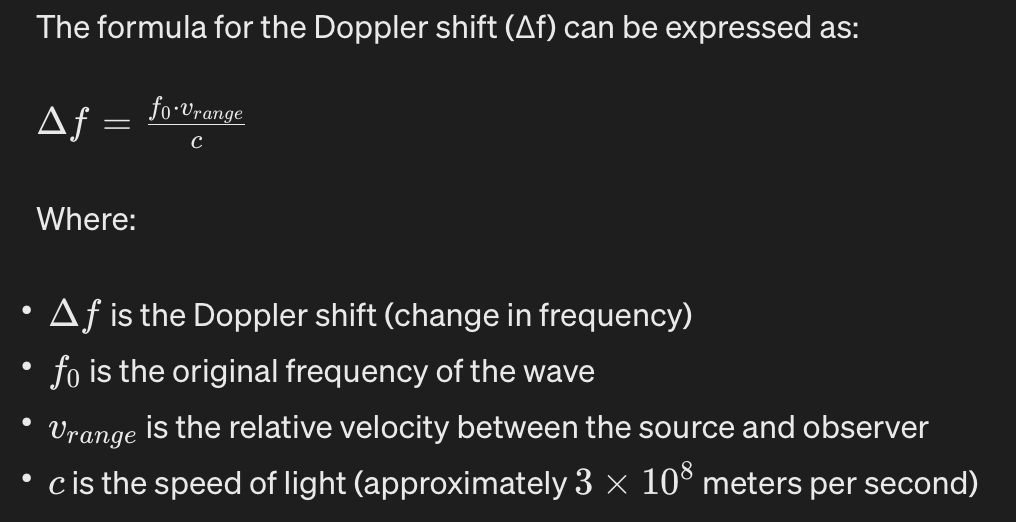
I am a very new Orekit-user and currently working on the Doppler shift function in my project. I am attempting to use the basic Doppler shift formula for calculations (get inspiration from Calculating Doppler Shift for satellites - Amateur Radio Stack Exchange). However, I am unsure if I am doing it correctly, as I currently can not test it with physical radio equipment. I would appreciate it if someone could help me verify if I have implemented it correctly.
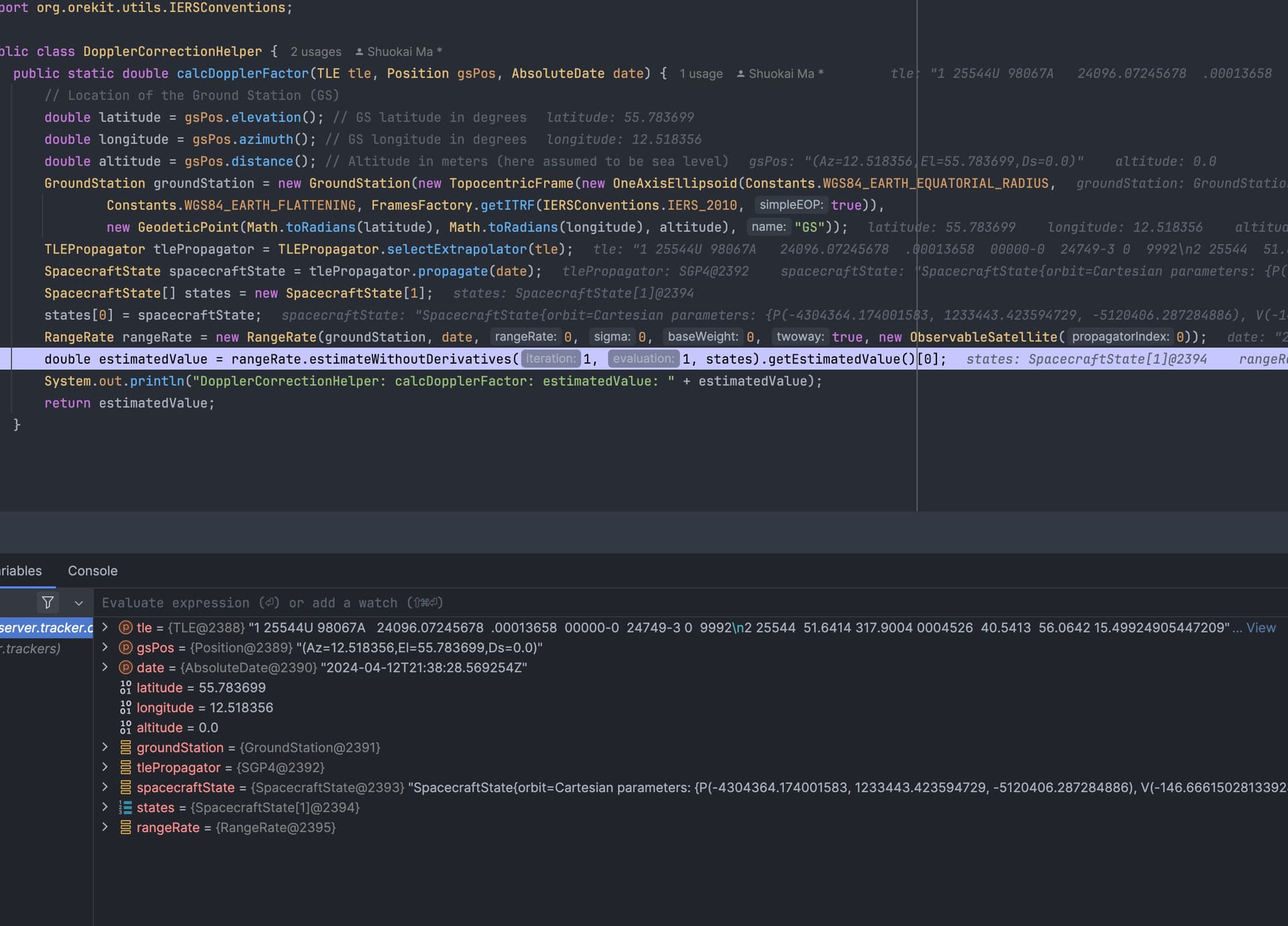
    public static double calcDopplerFactor(TLE tle, Position gsPos, AbsoluteDate date) {
        TopocentricFrame groundStationFrame = new TopocentricFrame(
                new OneAxisEllipsoid(Constants.WGS84_EARTH_EQUATORIAL_RADIUS,
                        Constants.WGS84_EARTH_FLATTENING,
                        FramesFactory.getITRF(IERSConventions.IERS_2010, true)),
                new GeodeticPoint(Math.toRadians(gsPos.azimuth()), Math.toRadians(gsPos.elevation()), gsPos.distance()),
                "Ground Station");

        // Initialize TLE propagator
        TLEPropagator propagator = TLEPropagator.selectExtrapolator(tle);

        // Propagate satellite position to current date
        PVCoordinates pv = propagator.propagate(date).getPVCoordinates();

        // Calculate satellite velocity
        Vector3D satelliteVelocity = pv.getVelocity();

        // Calculate ground station velocity
        Vector3D groundStationVelocity = groundStationFrame.getPVCoordinates(date, FramesFactory.getITRF(IERSConventions.IERS_2010, true)).getVelocity();

        // Calculate relative velocity
        Vector3D relativeVelocity = satelliteVelocity.subtract(groundStationVelocity);

        double relativeVelocityNorm = relativeVelocity.getNorm();

        // Calculate Doppler shift
        return relativeVelocityNorm / Constants.SPEED_OF_LIGHT;
    }