@AlekLee Here are a couple of diagrams to illustrate the points. First one shows what Luc means about the lowest-altitude point between sender and receiver not necessarily being either sender OR receiver:
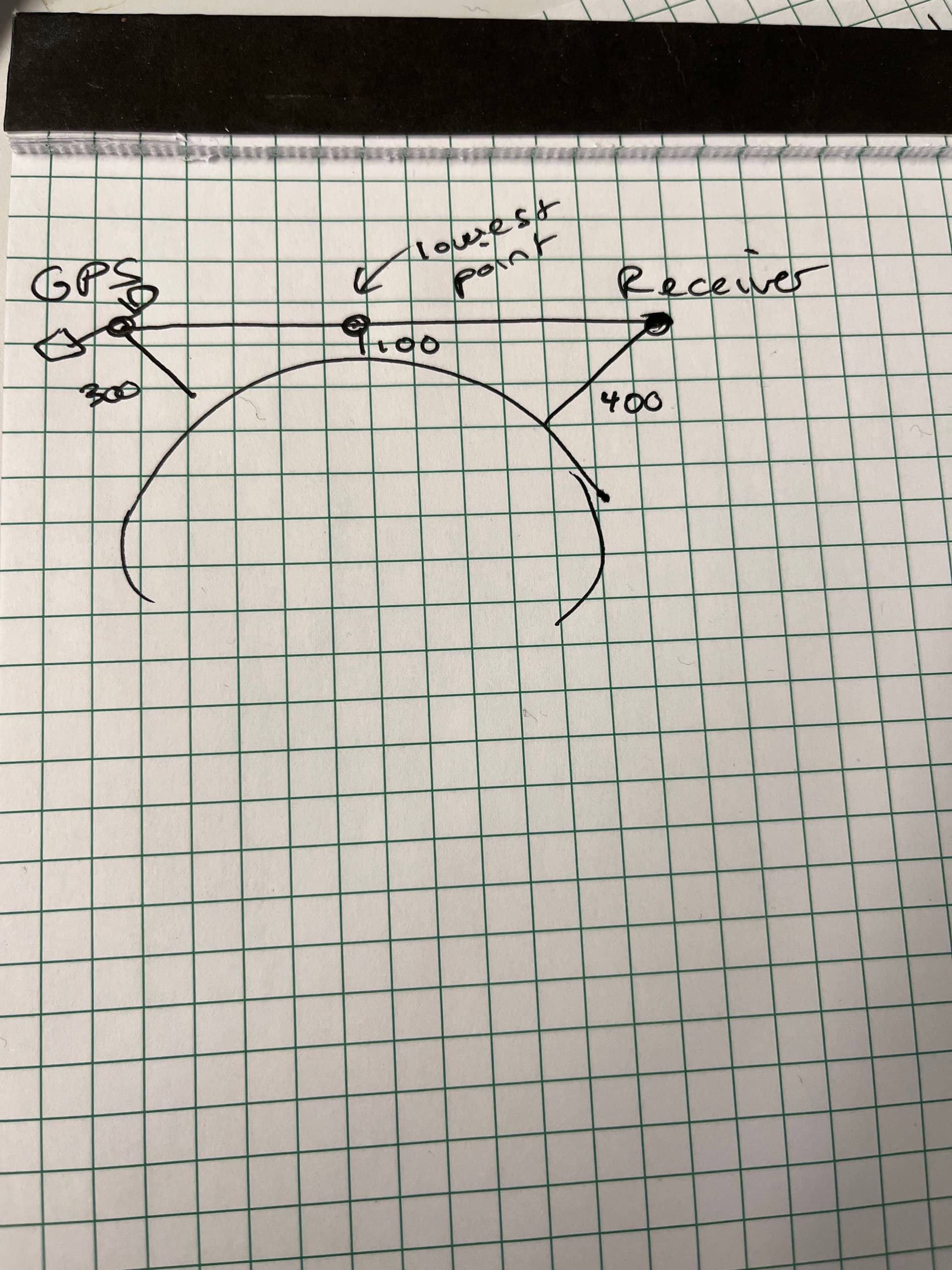
what Luc is saying here is that in order to properly calculate the delay between sender and receiver using the model, we’d have to calculate two legs: the first leg between the GPS sat and the lowest-altitude point, and the second between the lowest-altitude point and the receiver. Once my MR is done, this will happen automatically however and no one will need to worry about it anymore.
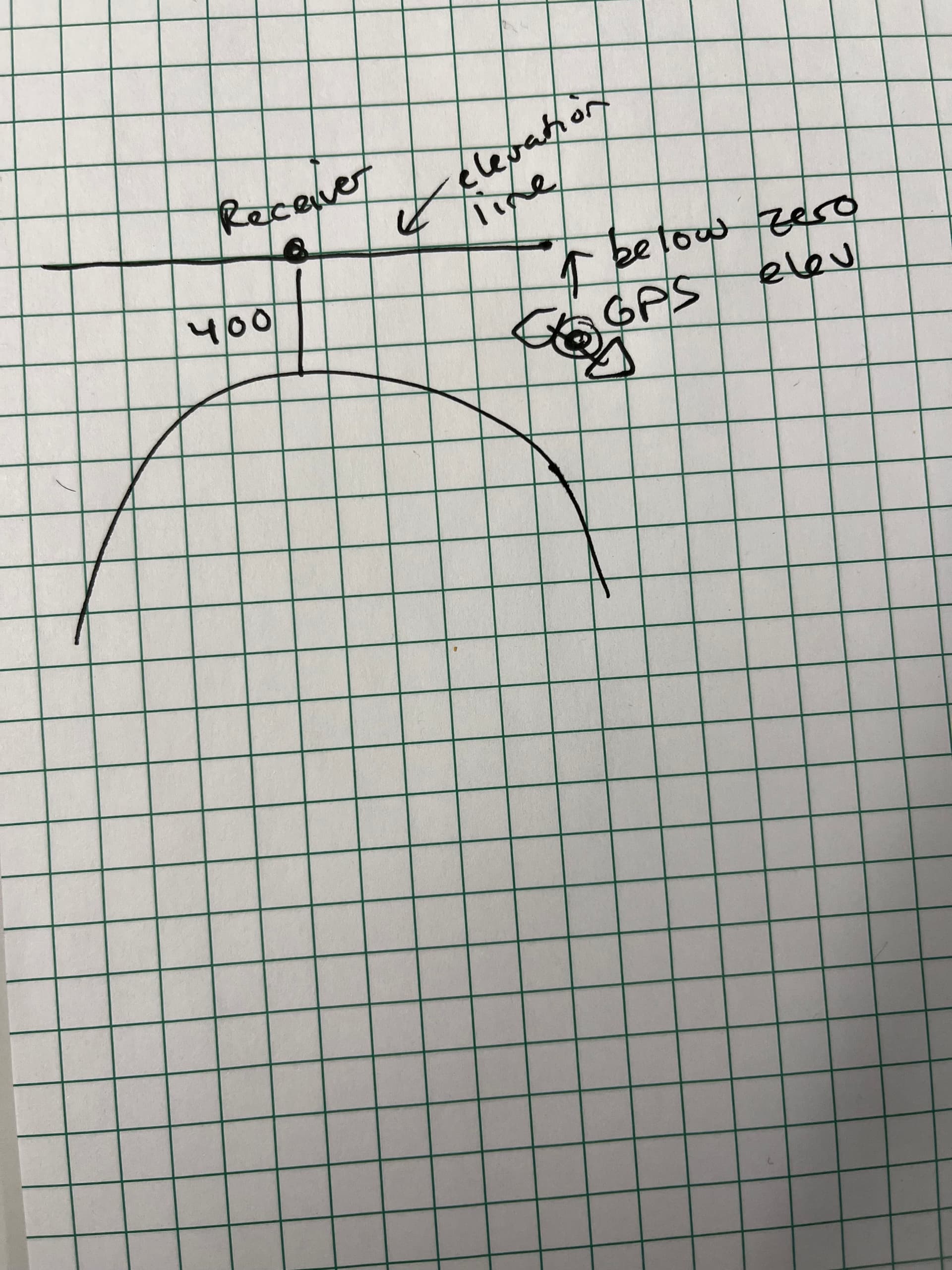
Second one shows what I mean about the GPS receiver possibly being “below your elevation”